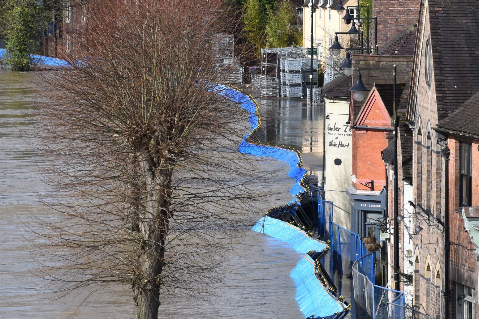
Ironbridge residents urged to leave homes as flood barriers overwhelmed
Residents in riverside properties in Ironbridge have been told to leave their homes and businesses immediately after temporary flood barriers were overwhelmed by water. The barriers holding back the floodwater from the River Severn moved overnight in Shropshire and police said they appeared to be buckling under the pressure.
Flooding along parts of the river, which remained close to its highest levels in some areas, is likely until at least Sunday, the Environment Agency said.
West Mercia Police Deputy Chief Constable Julian Moss said on Wednesday evening that officers were still in the process of evacuating properties along the Wharfage.
He said in a statement: "We are waiting to see what happens overnight and we are monitoring closely with colleagues at the Environment Agency, and an operational plan is in place with Shropshire Fire and Rescue should it be required."
Mr Moss said "virtually all" residents who had previously chosen to stay in their properties in Ironbridge, where a severe flood warning remains in place, have now left.
He added that the multi-agency response is set to continue for the next 10 days while flood waters are "likely" to be topped up during additional rainfall expected over the weekend.
Earlier, police could be seen knocking on doors along the riverside to ensure that residents living on Wharfage had left their homes.
Barriers were also erected in side streets to ensure that people did not approach the river.
Temporary flood defences along Wharfage had been pushed back towards a pub and other businesses, sparking fears that the defences could be fully breached.
Some residents declined to leave their properties, including one occupant who also opted not to move a car parked within yards of the riverside.
Residents in the Worcestershire town of Bewdley were forced to evacuate earlier after the river spilled over barriers at Beales Corner.
The Environment Agency forecasts the river level in the town, which has risen more than two metres in the past 72 hours, from 3.36m to 5.45m, will peak at 5.48m on Wednesday and remain at a near-record high into Thursday.
It reached its highest level of 5.56m on November 2, 2000.
Marc Lidderth, environment manager for the Environment Agency, said: "Over the next 24 hours, we will see the river levels remain elevated at Ironbridge and further upstream at Shrewsbury.
"Further downstream into Bridgnorth and Bewdley, the peak is making its way down the system. We will be seeing the peak at Bewdley happening round about later this afternoon.
"Unfortunately we have already seen some of our barriers over-topped there in the early hours, where properties have flooded. Obviously our thoughts go out to everyone that's been affected by that."
As the Environment Agency said that flooding is expected to continue into the weekend across parts of England, Boris Johnson was criticised by Jeremy Corbyn over his "silent" response to flooding across the country.
But the Prime Minister said he was "proud" of the response by ministers following the recent storms and defended the Government's investment in flood defences.
The most recent flooding happened after England received double the average amount of rainfall in February, with some areas receiving a month's worth of rain in 24 hours.
Some 92 flood warnings and 132 flood alerts issued by the Environment Agency remained in place at 8pm on Wednesday.
Operational teams have put up more than 6km of temporary flood barriers across the country and flood defences have protected more than 34,184 properties over the last week.
Flooding along parts of the River Severn is likely until at least Sunday and significant river flooding is also possible for parts of Yorkshire over the next five days and along parts of the River Trent in the East Midlands on Wednesday.
In East Yorkshire, flood warnings remain in place in the Snaith area, with the Environment Agency saying the washlands at Gowdall Ings are continuing to fill and are over-topping, as designed, into Snaith Ings, with flooding affecting properties nearby.
The Met Office said more wet weather is forecast, with the South West, the North West and southern parts of Wales expected to see the most rain on Friday and into the weekend.
And a yellow warning for snow and ice stretching the length of western Scotland down to Loughborough in the Midlands is due to come into force at 10pm on Wednesday.
Toby Willison, executive director of operations at the Environment Agency, said: "Our operational teams continue to work night and day to protect communities alongside the River Severn, which is experiencing record levels.
"River levels will remain exceptionally high on the Severn for some time and communities, in particular Shrewsbury, Bewdley, Bridgnorth and Ironbridge, should prepare for potentially ongoing severe flooding."
Mr Willison added: "We have already seen 200% of the average rainfall for February with more wet weather forecast.
"River levels have exceeded existing records across the country this winter with hundreds of the Environment Agency's river gauges surpassing all-time readings this decade.
"The Rivers Colne, Ribble, Calder, Aire, Trent, Severn, Wye, Lugg and Derwent are among the many rivers where records have been broken due to continuous wet weather."
Published: by Radio NewsHub